
This 27-mile urban trail connects the best of Boston parks via the unexpected hiking territory of city alleyways, staircases, and commercial streets. And it’s all accessible by public transportation, making it easy to find a hike right in Boston’s backyard.
It’s been said that within each person’s heart, there are two wolves and they are always fighting. For me, those wolves are the city and the backcountry. Growing up in Boston’s suburbs, I was a short walk away from the rustling leaves of the Middlesex Fells Reservation and the more cosmopolitan possibilities of the commuter rail. I worked as a wilderness lodge manager in the White Mountains and later, as a nightlife reporter operating out of the Fenway-Kenmore area. I wondered, usually after a few beers, if one could somehow merge the eclectic environment of the city with the sport of backcountry hiking. And in 2020, when a novel coronavirus suddenly forced us to stay home and seek therapeutic recreation in our own backyard, a beautiful thing happened: millions of us took to Boston’s parks and forests, exploring them with new intrigue.
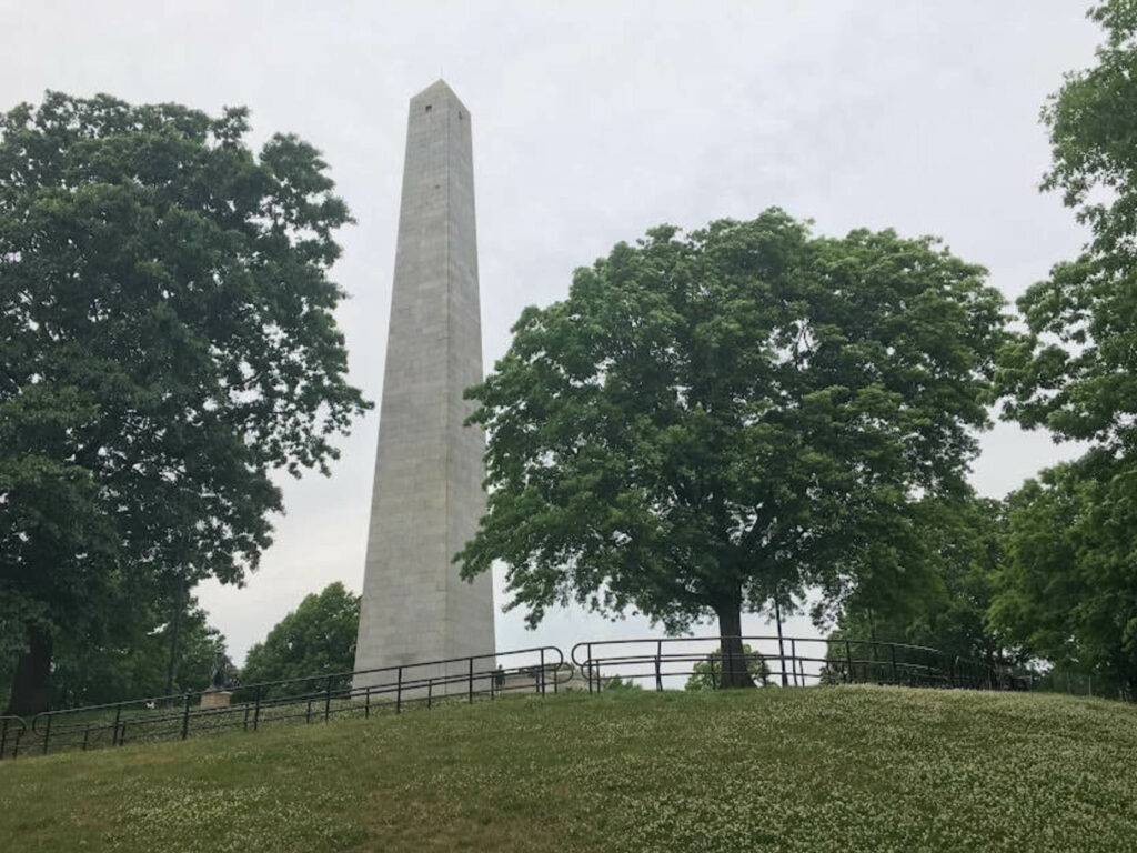
This is how the Walking City Trail—a 27-mile urban hiking trail through more than 30 Boston green spaces, from the Neponset River to the Bunker Hill Monument—first took root.
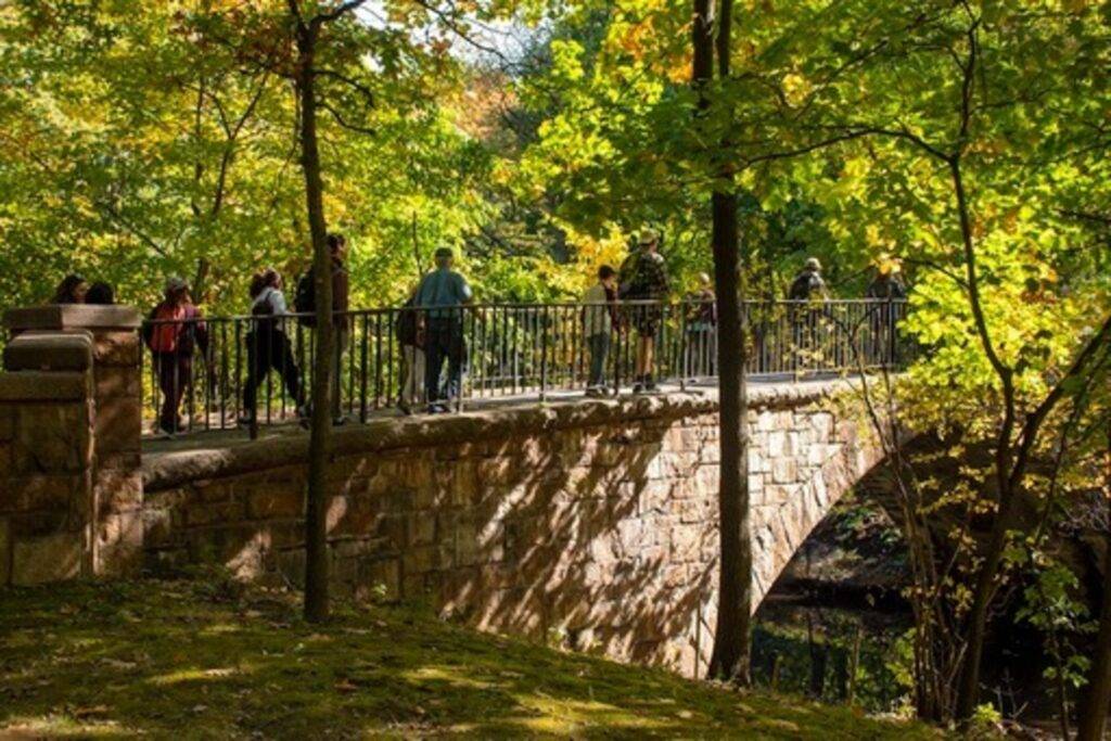
The Walking City Trail is a transit-accessible, park-to-park hiking route, navigable by free digital maps and directions. It’s Boston’s example of an emerging trail-building technique known as the “instant urban trail.” Instead of constructing a brand new physical pathway, instant urban trail builders track down the coolest pre-existing paths in urban or suburban green spaces, and then identify walkable connections between those paths. The connections can range from alleyways festooned with graffiti, to hidden staircases built into hillsides, to bustling commercial streets. Some of these segments aren’t what you normally think of as hiking territory. And yet, the final outcome is the same as backcountry hiking. You head home tired from the mileage, but elated by the scenery.
Instead of constructing a brand new physical pathway, instant urban trail builders track down the coolest pre-existing paths in urban or suburban green spaces, and then identify walkable connections between those paths.
One of the most visible and successful instant urban trails is San Francisco’s Crosstown Trail, which was launched in 2019 by a motley crew of volunteer trail-builders. During Year Two of the pandemic, when I picked up a copy of the New York Times with a feature story about the Crosstown Trail, it occurred to me that Boston needed a trail like this too. Historically known as “America’s Walking City,” Boston has the expansive pedestrian facilities to host trails like the Freedom Trail and the Black Heritage Trail. And today, every Boston resident lives 15 minutes from a park by foot. This impressive metric helped me identify the “theme” of the Walking City Trail: immersion. I wanted to create a trail that would engulf hikers in unique and memorable city environments, from the eeriest urban woodlands to the grandest ocean views.
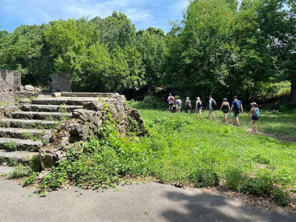
But picking a theme for an instant urban trail is the easy part. From there, the grunt work begins. After spending several days scouring wayfinding apps like Google Maps and AllTrails, flagging potential green spaces that could be included on the trail I was building, I knew it was time to get into the field and actually poke around those parks, wetlands, and forests. Since an instant urban trail prioritizes scenic curiosity―and because any trail should be reasonably free of natural hazards—I spent months in some of Boston’s vastest parks, comparing paths. In the Overlook Shelter ruins of Franklin Park, I puzzled over suspicious trail-side plants that looked like poison ivy, only to learn from a neighbor that they were, in fact, raspberry bushes. On the wooded peak of Mission Hill, I noticed signs warning park visitors of coyote activity, and I made a mental note to add this caveat to the trail directions. Finally, I made sure to route the trail past bus and subway stations when possible, so that Boston hikers could have the option to shorten or lengthen their hike—which, to me, is one of the essential perks of urban hiking!
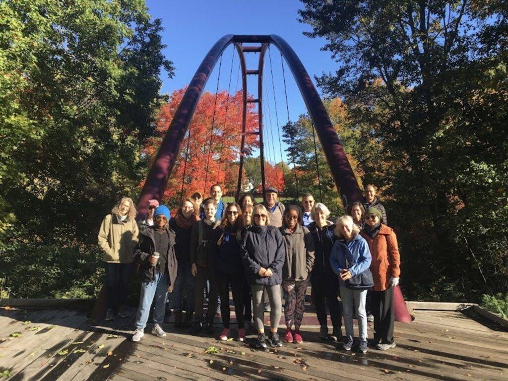
Since the official launch of the Walking City Trail website—the gateway to trail maps, directions, and more—the trail has evolved from a solo project into a community endeavor. Hundreds have hiked the “WCT,” as we now call it, and some of those hikers have become behind-the-scenes trail builders. The trail has lengthened and improved thanks to the ideas and insights of WCT hikers like Matthew Broude, co-founder of Downtown Boston’s Queer Neighborhood Council; Jules Murdza, an organizer with the Boston Dyke March; and Patrick Maguire, who is raising money for several nonprofits by walking the length of a marathon in every Boston neighborhood. Each month, we update the trail resources and send word about the trail’s latest evolutions and events so that Boston visitors and residents can go for a stellar hike in America’s Walking City.
Since the WCT traverses both paved and rugged surfaces, hiking shoes with good cushioning are more useful than thick, heavy-duty boots. Otherwise, the tools of the trail are quite similar to what you’d take into the backcountry: sunblock, bug spray, a rain jacket, extra socks, at least one liter of water, and your favorite munchies. Long pants will protect you from poison ivy that can take root in rustic parks such as Mattapan’s Edgewater Greenway or Hyde Park’s Sherrin Woods Urban Wild. Other than the occasional coyote—which you can avoid by ending your hike before sundown, when they’re most active—your biggest concerns will be ticks in grassy areas and cars at road crossings. In both cases, look carefully.
Urban hiking might sound like a new thing, but in fact, millions of us have been quietly doing it for years—walking from one green space to the next, memorizing the routes, and re-visiting these improvised routes with our friends. It’s only now that more of us are thinking of these urban hiking routes as actual trails, and codifying them with maps, instructions, and in cases like Worcester’s 15-mile East-West Trail, physical trail signage on trees, fences, and utility poles.
All of which shows that in 2023, hiking can happen in any city. But don’t just take my word for it. Come to Boston, hike the Walking City Trail, and experience that sense of possibility yourself.
Hiking The WCT in 48 Hours
Since 27 miles might sound intimidating, the Walking City Trail is divided into four sections that can be completed in piecemeal fashion. Each section has its own vibe, from remote forests, to splendorous parks, to the thrumming urban core of the city.
To hike the WCT in a single weekend, take the MBTA’s Mattapan trolley to the Harvest River Bridge and slowly make your way to the top of Bellevue Hill, the highest point in Boston, by snaking through vast woodlands like Stony Brook Reservation. Rest your legs and grab a hearty lunch in Roslindale Village before pressing onward into the sculpted majesty of Arnold Arboretum, Franklin Park, and the Southwest Corridor Park that runs adjacent to Boston’s Orange Line subway. A final foray through an unlikely forest in residential Jamaica Plain delivers you to the boat house at Jamaica Pond, where you can savor the sunset, walk over to nearby Centre Street for a decadent dinner, and take a quick bus or train ride to hotels in Back Bay.
The next morning, stretch those hamstrings, grab a nourishing breakfast, and make your way back to the pond. From here, you’ll follow the Muddy River through Frederick Law Olmsted’s Emerald Necklace linear park system before taking a strapping detour to the top of Mission Hill, by way of forgotten staircases and a hidden, house-sized boulder known as Nira Rock. Rejoin the river and follow it through the Fens to Esplanade Park on the Charles. From here, the Walking City Trail traverses Boston landmarks like the Public Gardens and Chinatown Park. Stop here for a bite before the trail swaps green space for “blue space” on the dreamy, oceanside Harborwalk, which will take you to the North End’s pocket parks and a river crossing on moving footbridges! The climb to the Bunker Hill Monument is the Mount Katahdin of this trail. If you still have gas in the tank, take the stairs to the top and gaze out at the city you just hiked.
I can not wait to do this. Thank you!