
Access these trails near Boston using public transportation.
As a guidebook author, I often spend my summers exploring the best New England hiking trails. It’s a good gig, and moreover, it’s a fun hobby. I don’t have to do too many backflips to explain that getting outside (in any form) helps foster an appreciation for our planet. Which is good, because I’m in my thirties now and I fear it’s too late for me to learn how to backflip. The bottom line is this: The more you have the opportunity to recreate outdoors, the more you may come to appreciate the preciousness of our natural world, and the more willing you may be to speak up for climate action at home and in your community.
Of course, there are still barriers to accessing the outdoors, particularly if you live in a city like Boston. I’ve chosen these hikes for their proximity to the city. And though navigating the MBTA often requires healthy blood pressure and a monk-like disposition, all are theoretically accessible by public transit. If you’re looking for a hike in the heart of The Hub, check out our story on the Boston Walking City Trail.
Blue Hills Reservation

Blue Hills Reservation is one of the signature hikes in Greater Boston, and for good reason. “If you’re tired and you’re sick of the city” (in the words of the great Lou Reed), the views of the skyline from this ridge will surely revamp your appreciation for old Beantown. Okay, Lou was probably talking about New York, but that’s the beauty of Boston: Head just 10 miles south and you can look back on the entire sprawl from a surprisingly dense forest. The tower on the summit of Great Blue Hill is the most popular destination in this 7,000-acre preserve, but the options are myriad. I like to watch the planes come into Logan Airport from the meadowy peak of Buck Hill.
Logistics
To get to the east end of the park, take any train that goes to Quincy Center (including the Red Line), then hop on the 238 bus. For the west end, your best bet is to head to Mattapan on the red line and hook up with the 716 bus.
World’s End Reservation
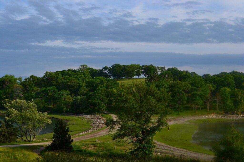
If you’re like me, and you’ve erased the entire South Boston Waterfront from your memory due to one terrible date at the Harborside Legal Sea Foods, it’s easy to forget that Boston is actually a coastal city. A lot of the action takes place inland of Route 93, but when you take traffic out of the equation, the sea is within arms reach. Escape to salt air and ocean views with a loop around the gentle carriage roads of World’s End Reservation in Hingham. Like Boston’s famous Emerald Necklace, this park was designed by landscape architect Frederick Law Olmsted. You’ll find his signature grassy expanses with stunning views across Hingham Harbor to the city skyline. A four-mile loop takes you through all the highlights, including Planters Hill, The Bar, and Rocky Neck.
Logistics
Take the Greenbush Line Commuter Rail to Nantasket Junction, followed by a roughly 15-minute walk. Alternatively, you can take the ferry to Hull and catch the 714 Bus.
Battle Road Trail
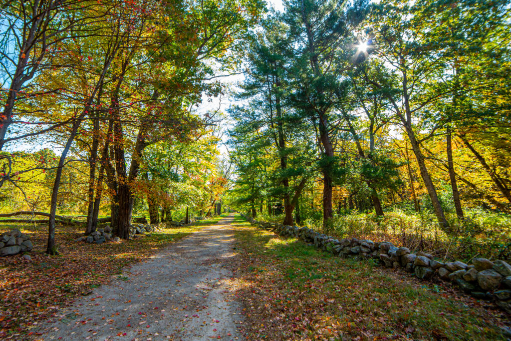
The five-mile Battle Road Trail between Lexington and Concord bends the expectations of what a New England hiking trail should be. There are no steep ascents or dramatic vistas. Instead, this accessible gravel doubletrack follows the route of the Massachusetts Minute Men who marched to meet British Regulars at the first battle of the American Revolution on April 19, 1775 — and it’s all the more exciting for it. Full disclosure: in the third grade I invented a board game called “The Midnight Ride of Paul Revere,” so I may have a nerdy predilection toward this sort of thing. Still, this out-and-back is chock full of historic sites dating back to when the “shot heard ‘round the world” was fired. The route is not far from the suburban centers of Lexington and Concord, but its forests, wetlands, and fields are a fitting backdrop for the reverent mood evoked by the battlegrounds.
Logistics
A combo of the Red Line and a bus will technically get you to the Lexington end of the trail, but the easiest option is to take the Fitchburg Commuter Rail into Concord from North Station or Porter Square.
Middlesex Fells Reservation
“The Fells,” as locals call it, is a superb destination north of the Mystic River for outdoor endeavors of all kinds: kayaking, climbing, mountain biking, you name it. And with over 100 miles of trails, Middlesex Fells has enough hiking options that even repeat visitors can get lost … I mean … find something new … every time. Choose your own adventure here, but I like the Rock Circuit Trail. This roughly 4-mile loop traverses the peaks of Melrose Rock, Black Rock, and Pinnacle Rock. The tallest of these “peaks” is a mere 249 feet, but the views of the Boston skyline are nonetheless spectacular. Plus, you’ll encounter some refreshing water features like the creatively named cascade “The Cascade.”
Logistics
Take the Orange Line or the Haverhill Line Commuter Rail north to Oak Grove Station in Melrose. From there, you can walk or the 132 Bus will deliver you directly to the trailhead.
Walden Pond State Reservation

After Frogger-ing your way across Route 126 and stepping onto the busy beach at Walden Pond, you might wonder if you’ve really arrived at the same patch of pastoral nature that inspired Henry David Thoreau. My advice: It’s there. You just have to walk to find it. Not that there’s anything wrong with the beach. This pleasant kettle-hole is favored by families and competitive swimmers alike — a 2021 attempt to ban open-water swimming caused a minor uproar, with swimmers threatening their own brand of civil disobedience against the Massachusetts DCR. You can once again swim to your heart’s content, but also be sure to take a stroll around the Pond Loop to experience a replica of Thoreau’s Cabin (the OG tiny home!), the colorful bog of Heywood’s Meadow, and the peaceful Emerson’s Cliff.
Logistics
No public transportation will bring you directly to the Walden Pond visitor’s center, but you can get fairly close by taking the Fitchburg Commuter Rail into Concord. Extend your hike by following the 1.7 mile Emerson-Thoreau Amble to Walden.